Shandong Fengtu IOT Technology Co., Ltd
Sales Manager:Ms. Emily Wang
Cel,Whatsapp,Wechat:+86 15898932201
Email:info@fengtutec.com
Add:No. 155 Optoelectronic Industry Accelerator, Gaoxin District, Weifang, Shandong, China


Sales Manager:Ms. Emily Wang
Cel,Whatsapp,Wechat:+86 15898932201
Email:info@fengtutec.com
Add:No. 155 Optoelectronic Industry Accelerator, Gaoxin District, Weifang, Shandong, China
time:2025-06-09 09:54:01 source:Weather Station viewed:396 time
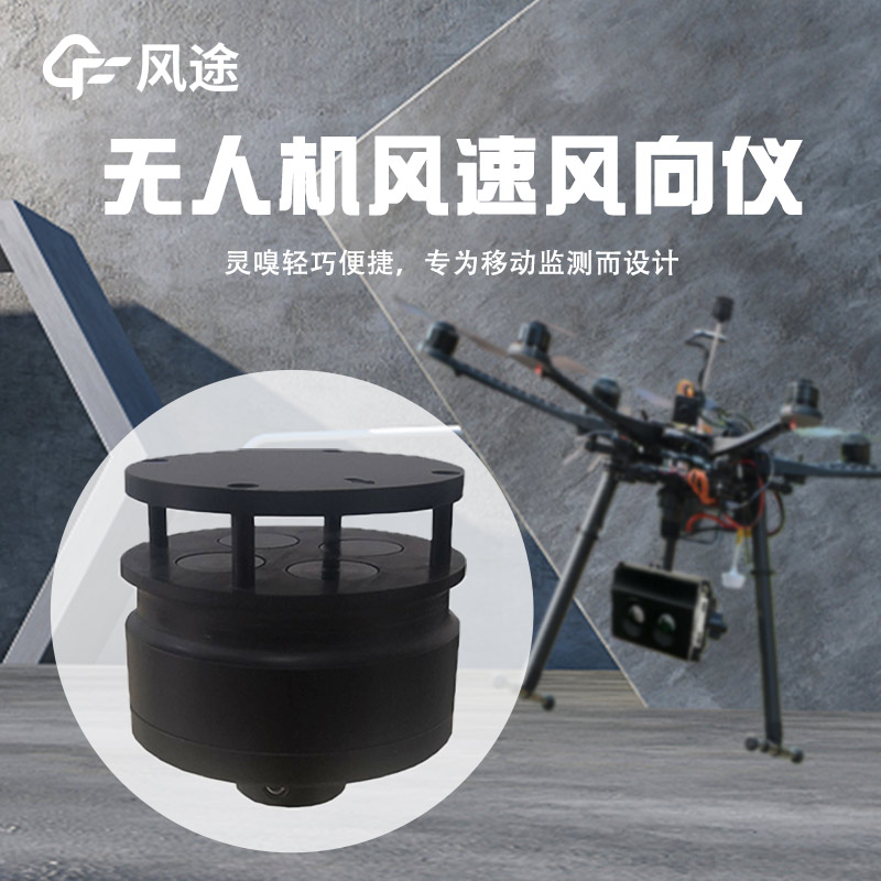
In the field of meteorological monitoring, the emergence of Drone-Based Weather Stations has undoubtedly achieved an organic integration of drone technology and meteorological monitoring technology, enabling precise and efficient meteorological data collection. The FT-F3 Drone-Based Weather Station is a typical example, demonstrating the "divine collaboration" between drones and meteorological monitors.
Drones offer the advantages of flexibility and mobility, capable of quickly reaching designated areas. They can easily traverse complex terrains without being restricted by ground transportation conditions. In meteorological monitoring missions, drones can arrive at target monitoring points in a short time, reducing the difficulties and risks of manual deployment to monitoring sites. Meteorological monitors, on the other hand, are key devices for accurately measuring various meteorological elements. The FT-F3 Drone-Based Weather Station is equipped with integrated meteorological sensors that can real-time monitor critical meteorological parameters such as atmospheric temperature, humidity, air pressure, wind speed, and wind direction.
When a drone carries the FT-F3 meteorological monitor, their "collaboration" begins to take effect. In meteorological scientific research, to obtain meteorological data at different altitudes and regions, drones can carry the monitor for all-around monitoring according to preset flight routes and altitudes. The monitor can real-time transmit data back to the ground control center, allowing researchers to promptly analyze this data for studying complex meteorological phenomena such as atmospheric circulation and climate change, providing rich data support for optimizing meteorological forecasting models.
In agricultural production, this "divine collaboration" also plays a significant role. Drone-Based Weather Stations can shuttle above farmland to real-time monitor farmland microclimates, helping farmers understand in-field temperature, humidity, and other information, thereby enabling more scientific planning of agricultural activities such as irrigation and fertilization to improve crop yield and quality.
In summary, the integration of drones and meteorological monitors—particularly the application of Drone-Based Weather Stations like the FT-F3—has significantly enhanced the efficiency and accuracy of meteorological monitoring, providing strong technical support for multiple fields such as meteorological research and agricultural production. Their role will become increasingly prominent as technology continues to advance.
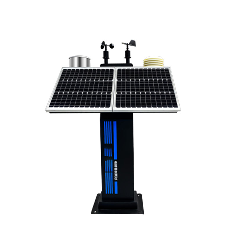
The 12-Parameter Agricultural Weather Station is a highly integrated, low-power, and rapidly deployable high-precision observation device. Comprising five key components—sensors, a data collector, a solar power system, a pole mount, and a cloud platform—it provides integrated monitoring of v...
Lightning Warning System is an atmospheric electric field detection device developed using MEMS technology based on the principle of charge induction; it contains no wear-prone mechanical components, such as motors. The device features a measurement range of -100 kV/m to +100 kV/m and a detect...
When driving in a tunnel, visibility monitoring is extremely crucial. The interior of a tunnel is relatively enclosed with limited air exchange and is prone to being affected by various factors that can reduce visibility. Such situations as bad weather, the accumulation of vehicle exhaust fumes, and...
For a long time, agricultural production has largely relied on experience and the observation of the weather. When it comes to sowing, irrigation and dealing with extreme weather conditions, decisions often depend on traditional wisdom passed down orally. Nowadays, agricultural meteorological statio...


 Skype
Skype
 whatsapp
 mail
mail