Shandong Fengtu IOT Technology Co., Ltd
Sales Manager:Ms. Emily Wang
Cel,Whatsapp,Wechat:+86 15898932201
Email:info@fengtutec.com
Add:No. 155 Optoelectronic Industry Accelerator, Gaoxin District, Weifang, Shandong, China

Sales Manager:Ms. Emily Wang
Cel,Whatsapp,Wechat:+86 15898932201
Email:info@fengtutec.com
Add:No. 155 Optoelectronic Industry Accelerator, Gaoxin District, Weifang, Shandong, China

Model:FT-ML3
Brand:fengtu
1.Introduction to Radar Flow Meter Products
ML3 radar wave fixed-point online flow measurement is a fully automatic flow telemetry system that can monitor the open channel water flow process throughout the entire process.This flow measurement system is not affected by temperature, humidity, rainfall, water depth, muddy water, and floating objects on the water surface.It is very suitable for flow testing under water conditions in open channels such as irrigation areas and rivers.
2.Radar Flow Meter components
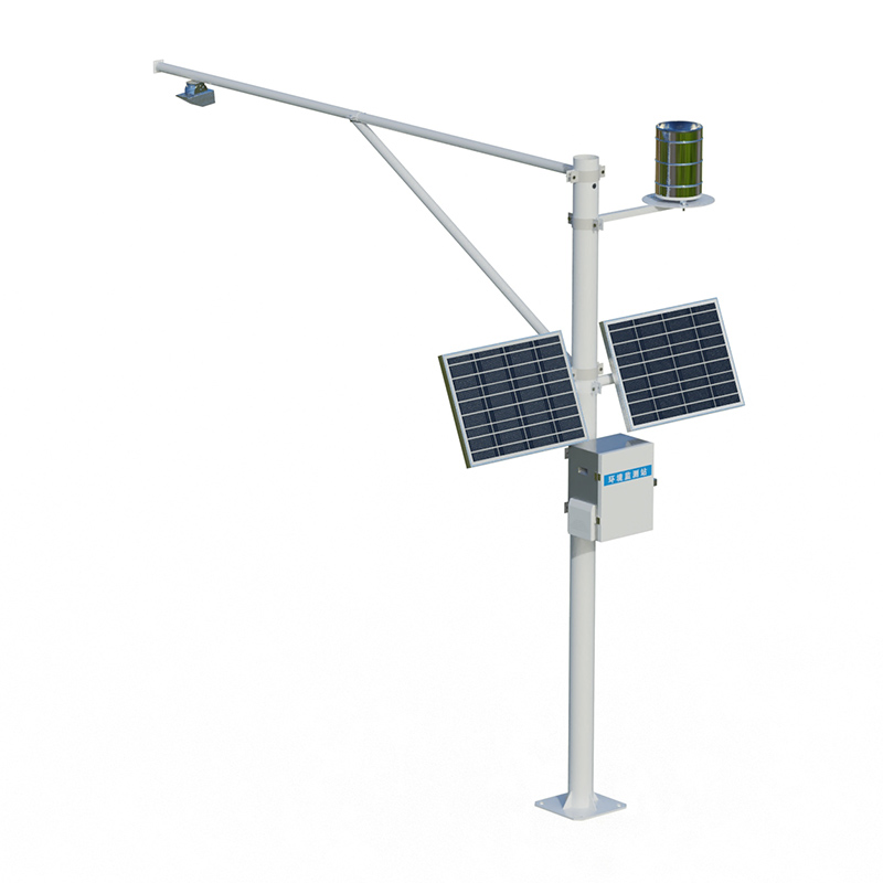
Main components
(1) Three-in-one radar water level surface flow velocity and flow;
(2) Telemetry terminal RTU;
(3) Solar power supply system;
(4) Pole and bracket;
(5) Lightning protection grounding.
3.Working principle of Radar Flow Meter
The radar surface flow velocity meter measures the surface flow velocity of the canal water body based on the principle of pulse radar technology.It is also used in conjunction with the radar water level sensor.It is installed at the regular sections of open channels such as rivers and irrigation areas to calculate the flow rate, that is, at the regular section, the velocity of the water flow through the section, and the depth of the water body is measured, and the water flow rate through the section is calculated through mathematical geometric principles.
4.Radar Flow Meter flow measurement station characteristics
The main feature of Radar Flow Meter is to measure flow by non-contact method.It mainly consists of a three-in-one radar water level flow rate flow rate sensor, which is suspended above the channel through a vertical pole mount.By measuring the water level depth and instantaneous surface flow rate of the regular section, the flow rate passing through the section at this moment is calculated.The main features are as follows:
(1) Advantages
It adopts non-contact type and can be installed with water, and is not restricted by channel water flow or accumulation of water;
No water blockage;
Not easily affected by debris and floating objects in the channel;
Not affected by water quality and sediment content;
Suitable for channels with faster flow rates and larger flow rates.
(2) Interference factors
Influence of wind speed: Wind speed can easily cause fluctuations in the water surface, resulting in false alarms and miscalculation;
Slow flow rate: When the water surface flow rate is slower, the measurement error increases;
Wind and sand weather: Wind and sand weather has a great impact on the signal strength of the radar wave, resulting in a large measurement error;
Heavy rainy weather: When encountering heavy rainy weather, radar waves are easily affected by the strong rain, resulting in large measurement errors.
5.Radar Flow Meter Technical Parameters
Water level measurement
Range measuring range: 0.1-40 meters
Range measurement accuracy: ±5mm
Range measurement resolution: 1mm
Interval time: 1-5000min
Flow velocity measurement
Range measuring range: 0.15~15m/s
Speed measurement accuracy: ±2%
Speed resolution: 0.01m/s
Flow measurement
Flow rate = average flow rate x overcurrent cross-sectional area x correction coefficient
The average flow rate is collected by the flow meter and calculated by the model.
The overcurrent section area is calculated from the water level measured by the water level meter and the cross-sectional information
Rainfall monitoring
Measuring range: rain intensity 0~4mm/min
Measuring accuracy: ±0.2mm
Resolution: 0.2mm
Rain diameter: φ200mm
Power supply method: combined power supply of solar panels + battery
Solar power: 100W (optional)
Battery parameters: DC3.7V 10Ah
Support height: vertical pole 3 meters cross arm 3 meters
Working environment: -45℃~85℃ (not freezing state)
Under the conditions of sufficient water vapor, gentle breezes, and a relatively stable atmosphere, once the air close to the ground cools down to a certain degree, the water vapor in it will condense into extremely tiny water droplets. These small droplets will then suspend in the air one after ano...
The Visibility Detector is mainly a forward-scattering visibility meter, which is an important instrument for measuring visibility.The transmitter and the receiver are kept at a certain distance and at a certain angle. The receiver only receives the forward-scattering light of the atmosphere. The tr...
In meteorological observation work, visibility is a key element. It intuitively reflects the transparency of the atmosphere and is related to many fields such as traffic travel, aviation and shipping safety. Briefly speaking, visibility refers to the maximum distance at which a person with normal vi...
The Fengtu Small Automatic Weather Station simultaneously conducts real-time monitoring of six core meteorological parameters: wind speed, wind direction, temperature, humidity, air pressure, and optical rainfall. The wind speed and direction sensors have a range of 0 to 60 m/s, with an accuracy of...